Submitted by Steve Turner on
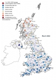
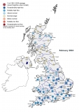
August was, for the most part, decidedly autumnal with cool temperatures and unsettled wet weather, until a glimpse of summer in the final week when August Bank Holiday Monday was the warmest on record (since it was introduced in 1965). Rainfall was generally persistent and showery, although in western parts of Northern Ireland intense thunderstorm activity triggered highly disruptive flash flooding and generated new period of record peak flows. Whilst north‑east England and south Wales were notably dry, Scotland, Northern Ireland and south-east England bore the brunt of the rainfall. Despite the wet weather, August was the driest of the last three months, concluding a summer which ranks amongst the top 10 wettest on record for the UK (in a series from 1910). Soil moisture deficits (SMDs) generally increased in August, though soils mostly remained wetter than average. August river flows were generally above normal in the west of the UK and near or above average in southern and eastern Britain, though flows in some less responsive catchments of southern and central England were notably or exceptionally low for the time of year. Reservoir stocks generally increased in the north and west of the UK and were substantially above average across northern Britain and Northern Ireland. Though some groundwater levels in the Chalk rebounded slightly relative to average, levels remained below normal or notably low across much of south-east England, suggesting that recharge will commence from a below normal baseline. As such, autumn and winter rainfall will have a pivotal role in determining the onset and magnitude of recharge, which in turn will be influential on the water resource outlook for 2018.


