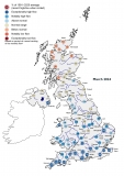
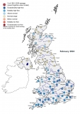
The NRFA’s peak flow data service provides flood data from river flow gauging stations around the UK. This includes both Annual Maxima and Peaks Over Threshold data at around 1000 river flow gauging stations throughout the UK. Additional information about the gauging stations is provided to allow hydrologists to make informed judgements regarding use of the data. A description of peak flow data holdings, describing data types, indicative suitability descriptions and useful definitions can be found here.
The data can be used with the statistical flood estimation methods set out in the Flood Estimation Handbook (FEH), which is the basis for most current flood estimation in the United Kingdom. This service is primarily aimed at experienced flood hydrologists and the web pages assume some knowledge of flood hydrology and the Flood Estimation Handbook.
As is the case with other NRFA data, the river flow data provided through this service originates from gauging stations operated by a range of UK organisations - including the extensive networks operated by the Environment Agency (England), Natural Resources Wales, the Scottish Environment Protection Agency and for Northern Ireland, the Department of Infrastructure - Rivers. Additional peak flow data and background information originates from the National River Flow Archive and the University of Dundee.
The provision of peak flow data by the NRFA commenced in April 2014. Prior to this date, this information was provided by other initiatives – most recently by the HiFlows-UK initiative. Further information about the history of this dataset can be found here.