 |
Although the administrative boundaries of the principal Measuring Authorities generally do not coincide with catchment divides, river flow measurement and hydrometric data collection is normally organised on a catchment or basin basis.
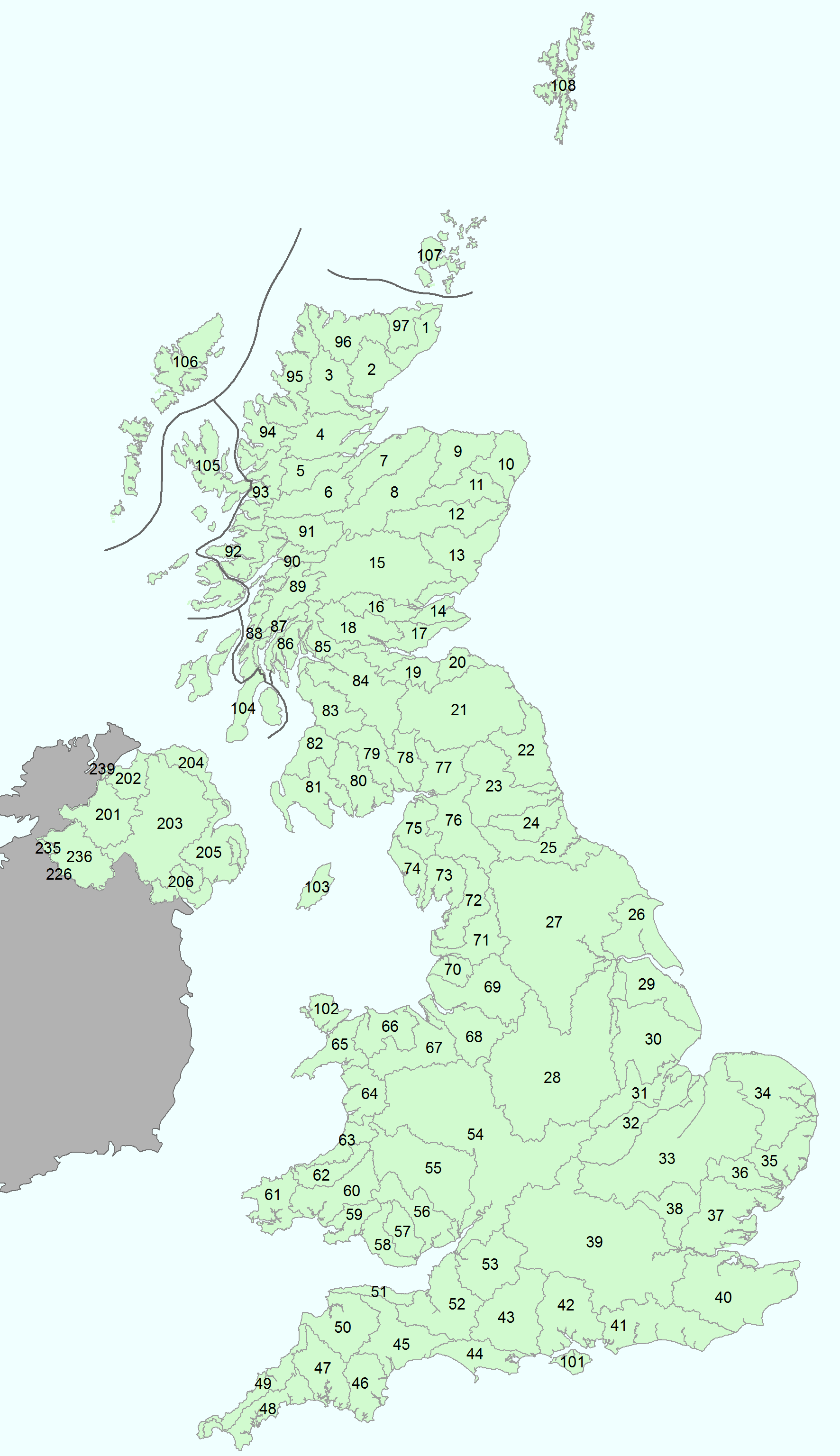
To help facilitate an integrated approach to the collection of hydro-meteorological data, the Surface Water Survey designated, in the 1930s, a framework of Hydrometric Areas across the UK; there are 107 in total (see map to the right).
Hydrometric Areas are either integral river catchments having one or more outlets to the sea or tidal estuary, or, for convenience, they may include several contiguous river catchments having topographical similarity with separate tidal outlets.
In mainland Britain they are numbered from 1 to 97 in clockwise order around the coast commencing in north east Scotland. The larger islands and groups of islands are numbered from 100: Isle of Wight (101), Anglesey (102), Isle of Man (103), Kintyre Group (104), Inner Hebrides (105), Outer Hebrides (106), Orkneys (107) and Shetlands (108).
Ireland has a unified numbering system from 01 to 40 commencing with the River Foyle catchment and circulating clockwise; not all Irish Hydrometric Areas, however, have an outlet to the coast. NRFA gauging station numbers are based on this system, consisting of the hydrometric area number, followed by 3 further digits. For gauging stations in Northern Ireland a prefix (2) is added to the station number (e.g. 203028).The numbers and boundaries of the UK Hydrometric Areas are shown on the map to the right.
The dataset can be accessed via the CEH Information Gateway here. The dataset should be cited as:
National River Flow Archive (2014). Hydrometric areas for Great Britain and Northern Ireland. NERC-Environmental Information Data Centre doi:10.5285/1957166d-7523-44f4-b279-aa5314163237


