Search data

About data

Accessing data
Peak Flow Dataset
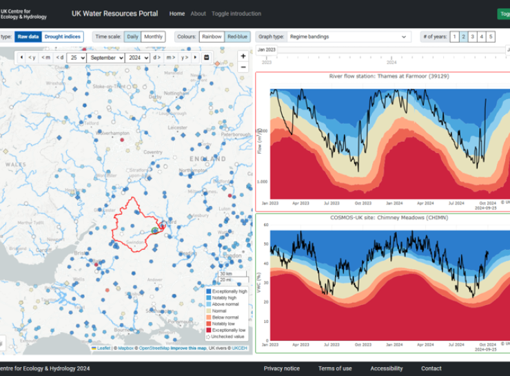
UK Water Resources Portal
UK Hydrological Outlook