Submitted by Steve Turner on
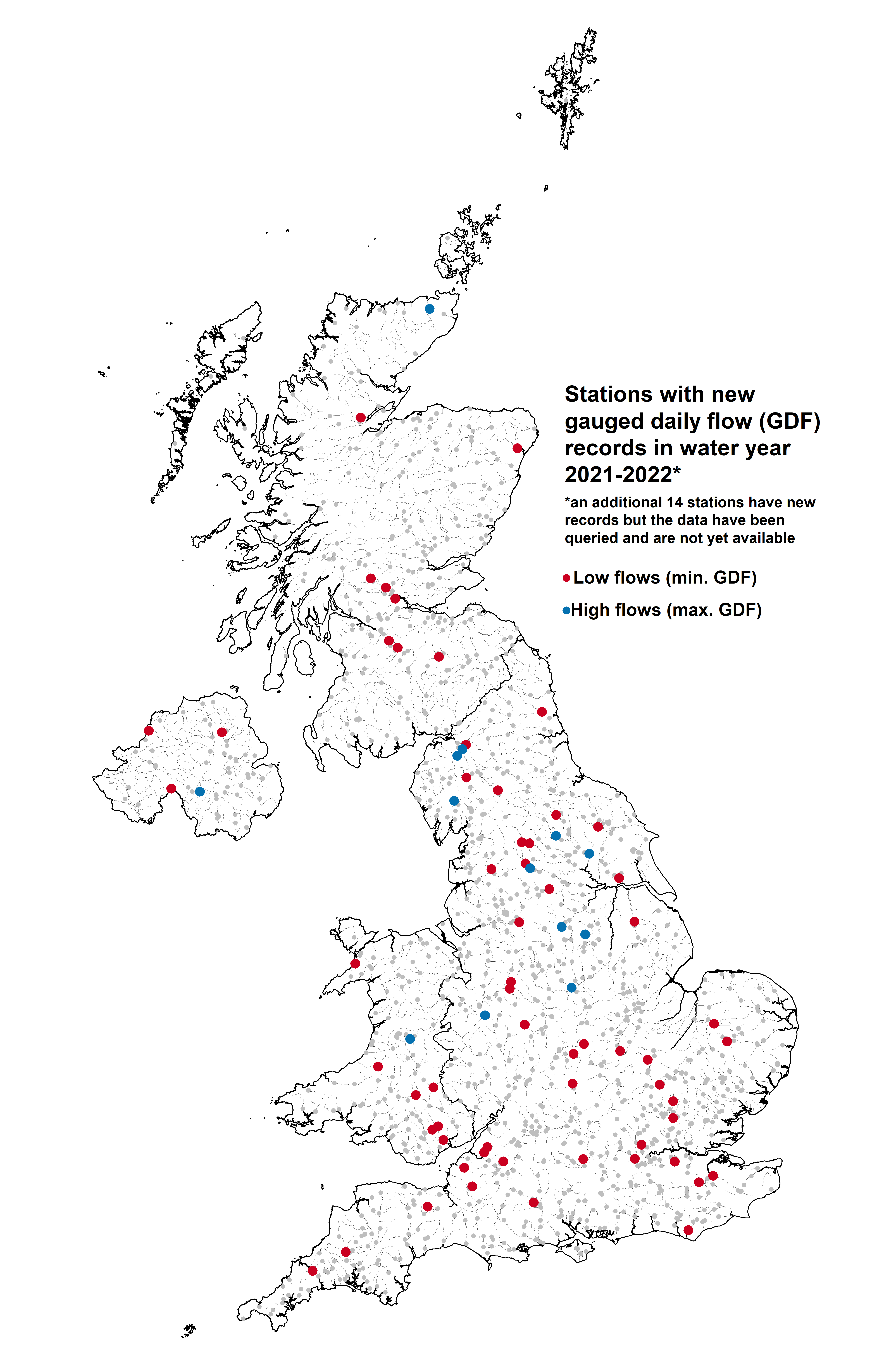
Daily flow data for the water year 2021/2022 are now available to download from the National River Flow Archive (NRFA) for most stations in the UK. This annual update contains new record flows for a number of stations, shown on the map below. It displays new record low flows (minimum daily flows) in red and new record high flows (maximum daily flows) shown in blue.
In 2022, a severe drought in the UK led to many new low flow records which are spread quite evenly over the country. The lowest flows however likely came after the end of water year 2021/2022 in September and October; therefore the map below likely doesn’t give a true indication of the record low flows experienced due to the 2022 drought. For more information about the 2022 drought, National Hydrological Monitoring Programme blog posts are available alongside the long-running monthly Hydrological Summary for the UK.
Some stations are still going through the yearly data quality control procedure and will be posted on the NRFA soon. Where more recent river flow data are required, users may be able to source this by contacting the relevant Measuring Authority, or by looking at the Live data tab which is available for most stations in England and Scotland.
For the yearly update of data, the daily flow data are provided to the NRFA by Measuring Authorities through an annual submission programme. Data for each water year are normally submitted to the NRFA the following spring, after which it undergoes detailed quality control process before being added to the national archive for the users.
Peak flow data (AMAX and POT) for water year 2021/2022 will be released later this year in September. The most recent release of files for use in WINFAP are available to download from our website.