Image
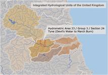
A new freely available dataset of spatial reference units for hydrological purposes, called "Hydrological Units of the United Kingdom" has been released. The dataset will aid hydrological analysis and water management in the UK by providing a consistent, nationwide framework for segregating river catchments into component parts. It also serves as a reference list of major river names and, by indicating which units are connected, it can be used to trace the flow of rivers across the country. More information.