On 3rd – 4th July 2024, Hertfordshire and North London Area (HNL) of the Environment Agency hosted visitors from the National River Flow Archive (NRFA; Catherine Sefton, Amit Kumar and regional representative Hadush Meresa) and the British Geological Survey (BGS; Andrew Mackenzie and Rachel Bell). This was the first of two visits by the NRFA in 2024, which aims to conduct two or three measuring authority liaison visits a year across the UK’s 24 regional hydrometric data providers.
On the first day, a meeting was held at Rothamsted Research in Harpenden and was well attended by HNL’s hydrometric and hydrological teams. It began with introductory presentations by both the NRFA, outlining the data and metadata holdings from the remit as national custodian of UK river flow data, and by BGS who maintain the sister archive of a network of boreholes, as the National Groundwater Level Archive. The main focus of the meeting was the HNL flow monitoring network, and discussion covered each of the 60 gauging stations currently held by the NRFA, and potential changes. Local expertise is invaluable in identifying improvements to NRFA holdings, with regard to network changes (station closures and new stations), daily and peak flow data, and associated metadata such as FEH Suitability, which indicates appropriate use of the data in flood estimation.
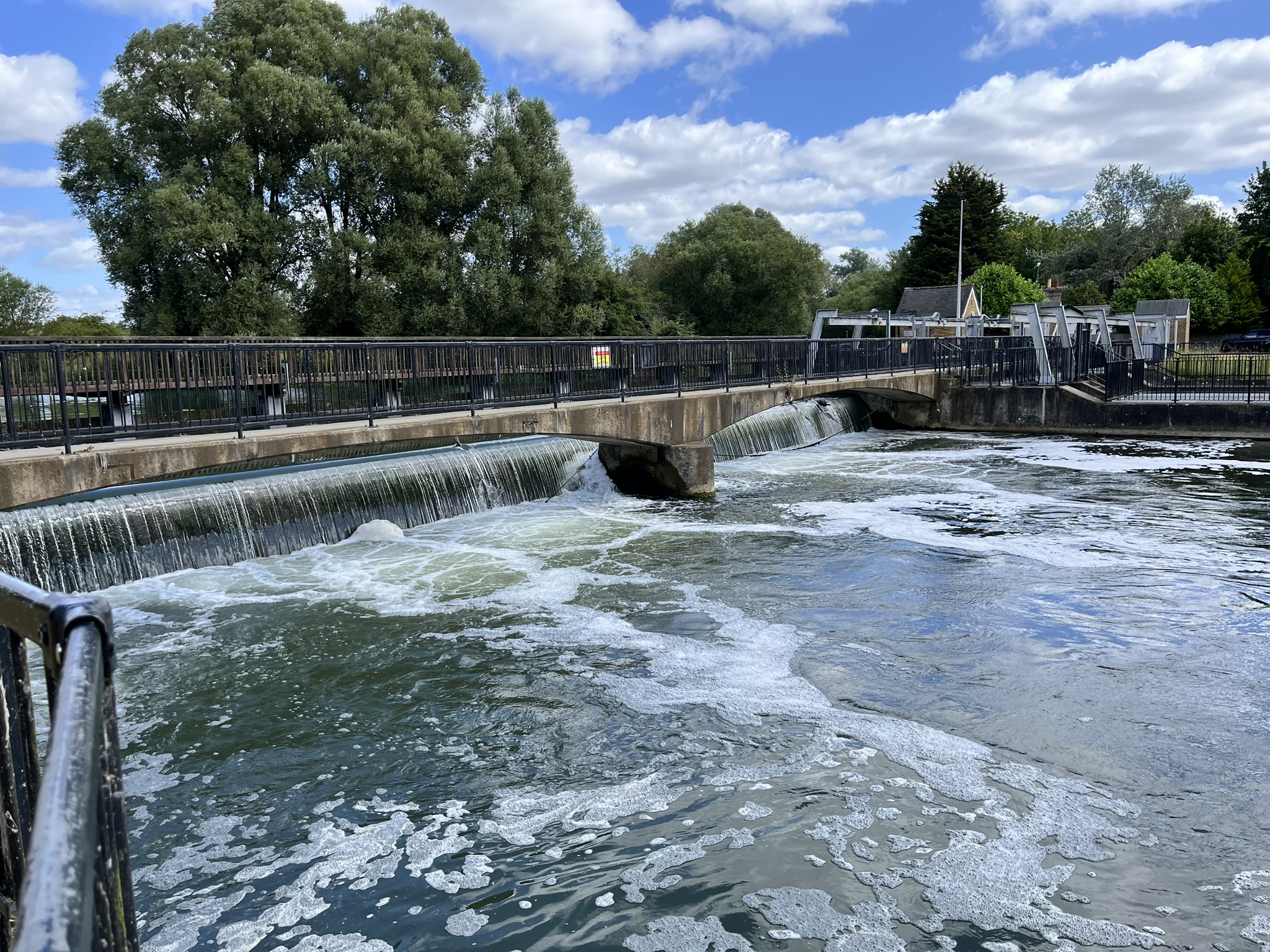
On the second day, HNL staff hosted visits to a number of gauging stations that are included in the NRFA. The Beane at Hartham (38030) has a flat V weir and was discussed with a view to upgrading it to hold peak as well as daily flows on the NRFA. The Lee at Feildes Weir (38001) is notable for the length of its record, which began in the 19th century, with flows since 1997 derived using gauging stations on the Stort at Glen Faba (38027) and the Lee at Rye Bridge (38031). Feildes Weir is one of two HNL stations used in monthly hydrological summaries for the UK published by the National Hydrological Monitoring Programme. On the canalised Stort, at its confluence with the Lee, the challenges of monitoring very low velocities were evident, mitigated by the installation of an ultrasonic time of flight gauging station at Glen Faba (38027). The Chess at Rickmansworth (39088) gauges a beautiful chalk stream and is notable for its selection as one of four observatory catchments in the UK under the Flood and Droughts Research Infrastructure project (FDRI).
Two gauging stations on the Bulbourne, at Old Fishery Lane and Two Waters Road, were also visited with a view to assessing their potential as additions to the NRFA. The flume and acoustic sidelooker (an index velocity station type) which capture all but the most extreme events make the site at Old Fishery Lane good for both daily and peak flow holdings, whereas the flume and bed-mounted doppler at Two Waters (another index-velocity type, installed because the water is not deep enough for a sidelooker) look to be bypassed by an ungauged channel.
The NRFA is indebted to Richard Woodbridge and his colleagues in HNL for their hospitality and knowledge. It was particularly helpful to learn about the relative merits and suitable locations for the installation of acoustic and ultrasonic instruments. Following the visit, a list of improvements to NRFA holdings is being processed, in consultation with the Environment Agency.