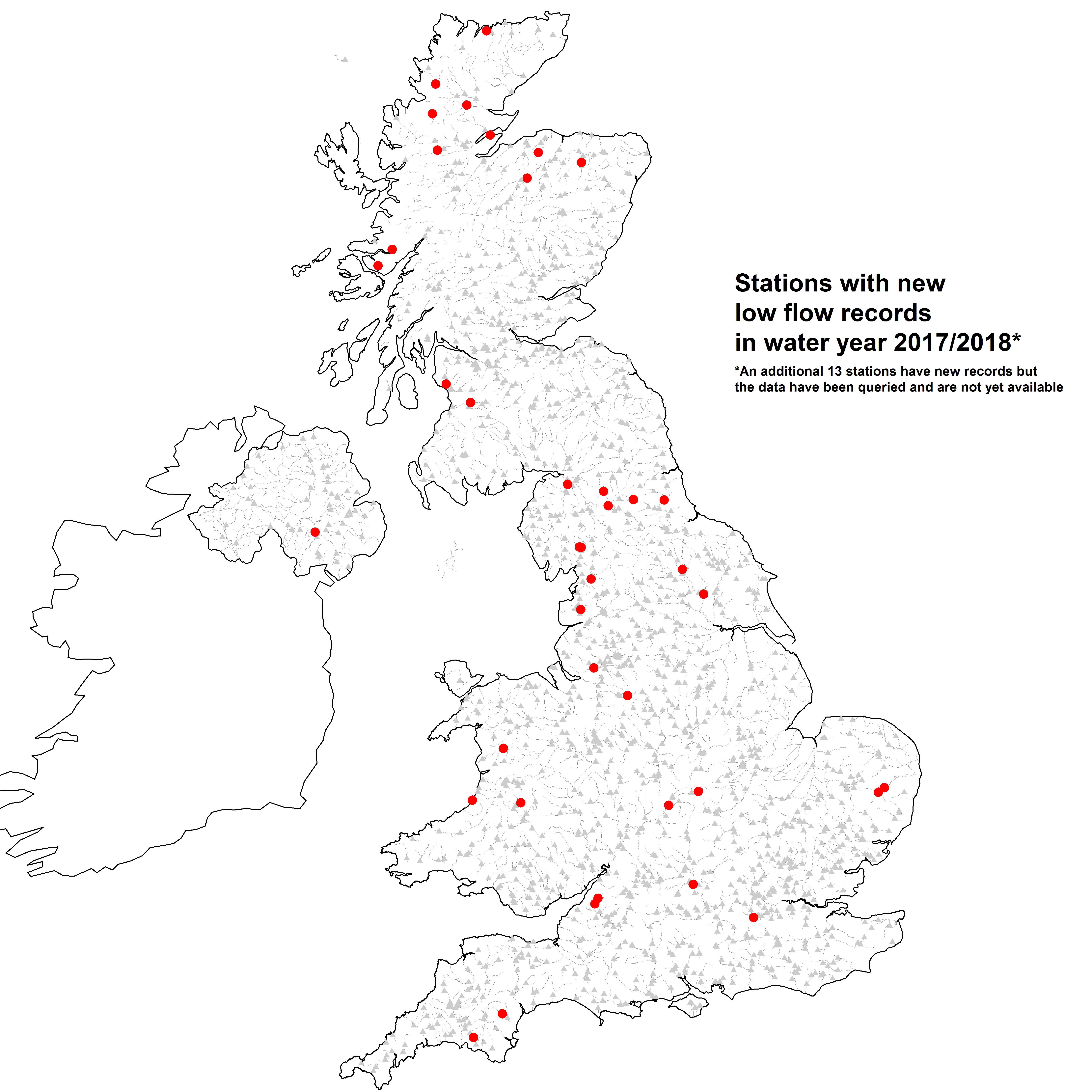
Daily flow data for water year 2017/2018 are now available to download from the NRFA for most stations in the UK. This annual update contains new record low flows for a number of stations (shown on the map below) during the dry summer, documented in our Hydrological Summaries and Hydrological Status Updates.
Some stations are still undergoing the quality control process and data for stations in Hydrometric Areas 10-20 have not yet been submitted to the NRFA. Where more recent river flow data are required, users may be able to source this by contacting the relevant Measuring Authority, or by looking at the Live data tab where available.
Daily flow data are provided to the NRFA by Measuring Authorities through an annual submission programme. Data for each water year are normally submitted to the NRFA the following spring, after which it undergoes detailed quality control before being added to the national archive.
Peak flow (AMAX and POT) data for water year 2017/2018 will be released later in the year. Download the most recent release of files for use in WINFAP.